Cart
You have no items in your shopping cart
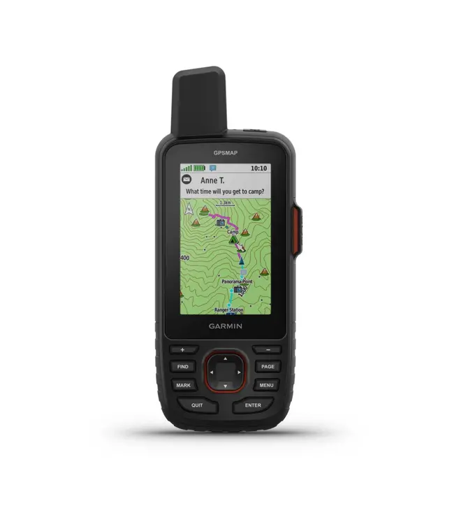
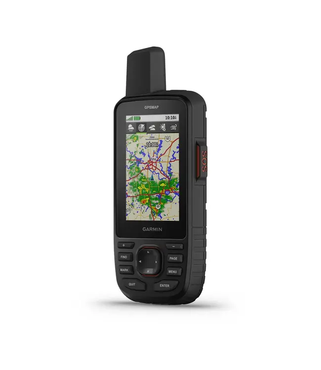
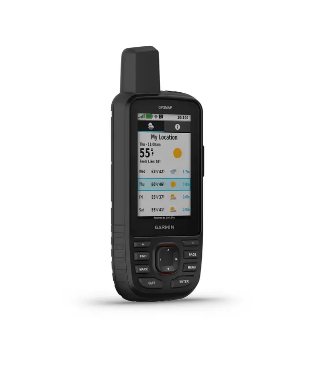
Make more time for adventure with this premium, rugged GPS handheld and satellite communicator. Get inReach® technology that enables two-way messaging, interactive SOS alerts and location sharing1 plus mapping to keep you on course. Read more..
Travel longer with up to 165 hours of battery life in tracking mode and up to 425 hours in expedition mode.
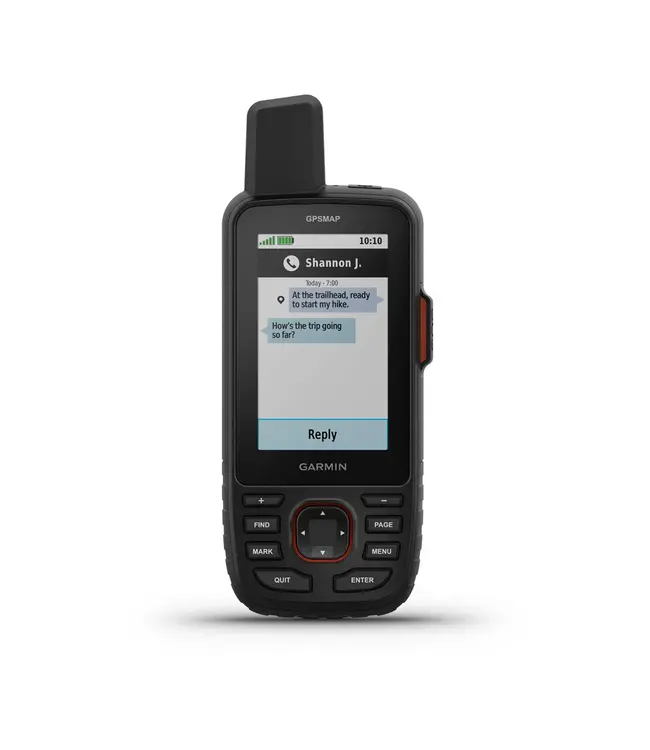
Two-way messaging lets you share the moment with the ones who matter.
Let your loved ones follow your adventure with location tracking.
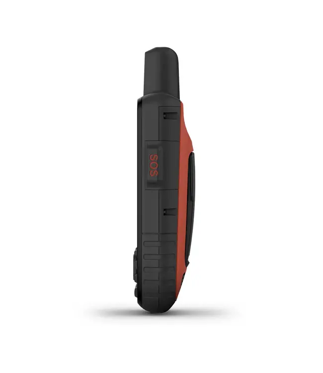
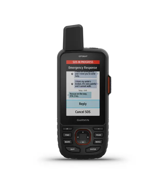
Have an emergency? Trigger an interactive SOS alert anytime, globally.
General |
|
| Lens Material |
chemically strengthened glass |
|---|---|
| Dimension | 2.5” x 6.4” x 1.4” (6.2 x 16.3 x 3.5 cm) |
| Weight |
8.1 oz (230 g) with batteries |
| Water rating | IPX7 |
| MIL-STD-810 | yes (thermal, shock, water) |
| Display Type | transflective color TFT |
| Display Size | 1.5"W x 2.5"H (3.8 x 6.3 cm); 3" diag (7.6 cm) |
| Display resolution | 240 x 400 pixels |
| Battery type | rechargeable, internal lithium-ion |
| Battery life |
Up to 165 hours with inReach® enabled with 10 minute tracking |
| Memory/History | 16 GB (user space varies based on included mapping) |
| Interface | USB-C |
Maps & Memory |
|
| Preloaded maps |
yes (TopoActive, routable) |
|---|---|
| Ability to add maps | yes |
| Basemap | yes |
| Automatic routing (turn by turn routing on roads) for outdoor activities | yes |
| Map segments | 15,000 |
| Satellite Imagery | yes (direct to device) |
| Includes detailed hydrographic features (coastlines, lake/river shorelines, wetlands and perennial and seasonal streams) | yes |
| Includes searchable points of interests (parks, campgrounds, scenic lookouts and picnic sites) | yes |
| Displays national, state and local parks, forests, and wilderness areas | yes |
| External memory storage | yes (32 GB max microSD™ card) |
| Waypoints/favorites/locations | 10,000 |
| Courses | 250, 200 course points per course |
| Tracks | 250 |
| Navigation Track Log | 20,000 points, 250 saved gpx tracks, 300 saved fit activities |
| Activities | yes |
| Navigation Routes | 250, 250 points per route; 50 points auto routing |
| Rinex logging | yes |
Sensors |
| GPS |
|---|
| Galileo |
| QZSS |
| BeiDou |
| IRNSS |
| Barometric altimeter |
| Compass |
| High-sensitivity receiver |
| GPS compass (while moving) |
| Multi-band frequency support |
Daily Smart Features |
| Connect IQ™ (downloadable watch faces, data fields, widgets and apps) |
|---|
| Smart notifications on handheld |
| Weather forecasts |
| Active Weather |
| Compatible with Garmin Messenger app |
| VIRB® Remote |
| Pairs with Garmin Connect™ Mobile |
Tactical Features |
|
| XERO™ Locations | yes |
|---|---|
| Ballistics solver | yes (unlock required) |
Outdoor Recreation |
| Point-to-point navigation |
|---|
| TracBack® |
| Area calculation |
| Fish forecast |
| Sun and moon information |
| Geocaching-friendly |
| Custom maps compatible |
| Picture viewer |
| LED beacon flashlight |
inReach® Features |
| Interactive SOS |
|---|
| inReach weather |
| Send and receive text messages to SMS and email |
| Send and receive text messages to other inReach device |
| Send and receive group messages |
| Exchange locations with other inReach device |
| MapShare compatible with tracking |
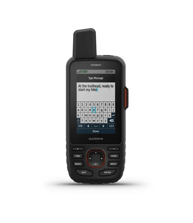
| Virtual keyboard for custom messaging |
| Send waypoints to MapShare during trip |
| Send route selection to MapShare during trip |
Track your position in challenging conditions with multi-band technology and expanded GNSS support.